
Geophysics
How Agile Software Empowers Better Surface Decisions
How Agile Software Empowers Better Surface Decisions As geological research becomes increasingly complex, the tools used to collect, analyze, and…

Seisware is now a part of Computer Modelling Group Ltd.

Exploring the subsurface is exciting but features on the surface are just as important as those below. Basic layer data, like rivers and roads, are important in new projects for orienting yourself and for planning future development. If you don’t have a dedicated data provider, these can be tricky to find. Don’t worry, SeisWare Product Owner, Alana Chin, did some groundwork and tested various compatible public data layers to get you started. Read on for some helpful tips from Alana!
Most searches for public Canadian geospatial data layers will lead you to the main Government of Canada and Natural Resources Canada (NRCan) pages. These can be tricky (frustrating) to navigate and extract data from. While not all features are available for download (or correctly linked), some older features are still downloadable.
A bit more sleuthing uncovered accessible and free data from NRCAN using this handy FTP link. Within the listings are a few gems, which we’ve laid out below.
Curious about what’s above your wells or next project? Good news! Landsat 7 imagery is available at a 1:50,000 scale and you can bring it into your project.

The raster files we downloaded from this dataset are already registered in the correct UTM zone and in UTM coordinates for easy import into your Geology, Geophysics, and/or Field Development project. (Have you used our Coordinate Converter? It’s super handy for batch coordinate conversion and free to download!)
The CanVec series contains shapefiles by province that download easily into SeisWare projects. These layers are in Lat/Long NAD83 but can easily be converted on import. Don’t want an entire province worth of data? Restrict your project area when using the Culture Importer to avoid this problem.

Image: Features in vector format and easily integrated into SeisWare projects are shown. Image modified from canada.ca
With a variety of resolutions available, the 1:50,000 (filename *_50K) has the best resolution/detail for localized projects.

Image: Shapefiles are available at different resolutions. Image modified from canada.ca
What does it look like when you put it all together? Check out this quick video of data over the City of Calgary area to see a preview.
Where do you go for open-source geospatial data? Let us know on social media!
Share this postHow Agile Software Empowers Better Surface Decisions As geological research becomes increasingly complex, the tools used to collect, analyze, and…
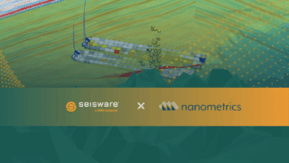
Calgary, AB – May 7, 2026 — SeisWare is excited to announce a new integration with Nanometrics that brings high-fidelity…

Why Geoscience-Engineering Misalignment Costs Millions In the oil and gas industry, true integration between geoscience and engineering has been recognized…
Our free monthly newsletter gives you access to our most valuable tools, resources, and insights without the unnecessary extras.

"*" indicates required fields

"*" indicates required fields
"*" indicates required fields
"*" indicates required fields